


Arches National Park offers a wide range of things to do and places to see. Look through the information below to gain a greater perspective of the park's layout and the best way to plan a trip to see it.
Park Layout
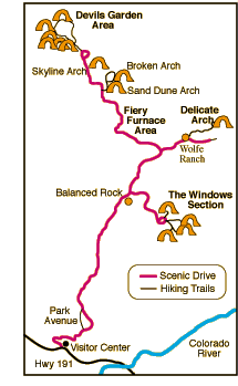
Arches is best explored by car and can be tackled in one day -- though a greater investment of time will yield a better appreciation for the wonderful geology of the park. A paved two-lane road runs about 18 miles one-way through the park, with a few short turnoffs along the way. Many of Arches' sites are visible from pull-offs along the road, but the best views take some short hiking over well marked trails.
Park Highlights
 Park Avenue
About 2 miles into the park is an area known as Park Avenue, so named for its towering sandstone fins that rise 150-300 feet and present nature's version of a skyscraper lined city street. A pull-off provides a good view. An easy trail leads through Park Avenue providing a perspective from beneath the "buildings." The hike is 1 mile if you arrange to get picked up at the other side. (See map.)
Windows Section
The Windows Section of the park is home to several large arches. Most can be be viewed from pull-offs or can be hiked to on short easy trails.
Double Arch is an impressive pair of connected arches -- one 144 feet wide and 112 feet tall, the other 61 by 86 feet.
Turret Arch, North Window and South Window are located along the relatively easy Windows Trail. Turret Arch is 65 feet high and 35 feet wide; North Window is 48 by 90 feet; and South Window is 56 by 155 feet.
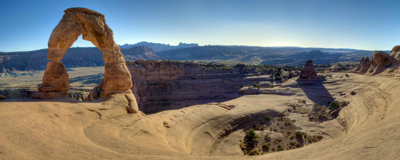
Delicate Arch
Delicate Arch is a extraordinarily beautiful and graceful structure. It is a must see. You can hike to it on the splendid, moderately difficult Delicate Arch Trail. You can also observe it from a viewpoint .5 miles away.
Fiery Furnace
The Fiery Furnace is a maze of narrow canyons created by tall, red sandstone fins. There is a pull-off view of the area, but to really experience its beauty, a hike through is highly recommended. Hiking through the narrow canyons is so confusing, hikers must either join one of the twice daily ranger led hikes or obtain a permit for a small fee to enter the area. See Fiery Furnace Trail.
Devils Garden Area
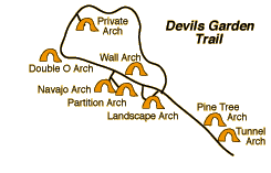 Located at the end of the 18 mile road through the park, the Devils Garden area is the site of the largest number of named arches in the park. The Devils Garden Trail takes you to all of them.
With a span of 306 feet and a height of 106 feet, Landscape Arch is the largest arch in the park (and the largest in the world). Landscape Arch is an easy .8 mile hike from the trailhead. From Landscape Arch you can continue along a loop trail that passes numerous arches. (See Devils Garden Trail for details.)
Some Other Things to Know
There are numerous other sites and lookouts along the Arches Park Scenic Drive. These are identified on the official map and guide to the park available for free at the entrance gate. Be sure to pick one up. You might also wish to stop at the Visitor Center located near the entrance to the park for additional information.
Pets
If you are wanting to bring your pet along with you on your trip, please be aware that activities with pets are very limited at Arches National Park. Pets may accompany visitors in the campground, and at overlooks and pullouts along the paved scenic drives, but are not allowed on any hiking trails. Pets may be walked on roads or in parking lots, but must be leashed at all times when outside a vehicle. Pets may not be left unattended (except in a paid-for campsite in the Devils Garden campground, where they must not cause a disturbance).