


Bryce Canyon National Park isn't a singular canyon, more like a plethora of them. Look through the topics below and gain a better orientation of the park and the best way to plan a visit there.
Park Layout
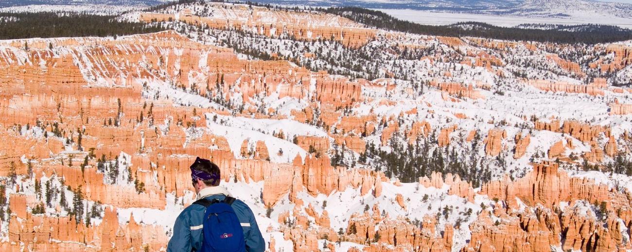
Bryce Canyon is not really a canyon, but rather a series of amphitheaters carved by erosion from the edge of the Pausaugunt Plateau. The park's main scenic drive runs atop the plateau connecting various lookouts over the amphitheaters. Hiking trails run along the rim and down into the amphitheaters.
The park is relatively small, stretching just 18 miles north to south and 6 miles across at its widest point. You can experience it adequately in a day, though longer stays will be rewarded. While Bryce Canyon is beautiful anytime of the day, it is most spectacularly colorful near sunrise and sunset. Special effort should be made to be at the rim for either (or both). The best views in the park are from Sunrise Point, Sunset Point, Inspiration Point and Bryce Point. They form a semi-circle around the Bryce Amphitheater, which is the largest and most spectacular in the park. Nearby Fairyland Point offers a view almost as good over the adjacent Fairyland Amphitheater. The easy Rim Trail runs along the edge of the plateau and connects each of these lookouts. Beyond Bryce Point to the south are numerous lookouts over other amphitheaters in the park. Each affords a little different view of the wonderful geology and distant landscapes. Each are worthwhile though none are as dramatic as the views over the main Bryce Amphitheater. Of these Paria View, Aqua Canyon, Ponderosa Canyon, and Rainbow and Yovimpa Points provide the best views. Also worth a stop is Natural Bridge, which is really a large arch. You can (kind of) look through it to the scenery below. | ||||
Park Highlights
| Rim Trail |
| | The Rim Trail runs along the edge of the plateau above Fairyland and Bryce amphitheaters. It connects Fairyland Point, Sunrise Point, Sunset Point, Inspiration Point and Bryce Point. It is 5-1/2 miles long in total but can be picked up at any of the lookouts and traveled just as long you want. It is paved between Sunrise and Sunset Points and provides wonderful views all along. Think about strolling it early in the morning or just before sunset. Click here for additional details on Rim Trail. | |
| Fairyland Loop, Queens Garden and Navajo Loop Trails |
| |
As the map to the right shows, the next three trails -- Queens Garden, Navajo Loop and Peekaboo Loop -- are interconnected within Bryce Amphitheater, giving you the ability to combine trails in several different ways. One of the most popular is to combine a descent on the steep Navajo Loop Trail with an ascent up the easier Queens Garden Trail, and then return along the Rim Trail to create a 3-1/2 mile loop. Click here for additional details on Fairyland Loop Trail. The popular Queens Garden Trail descends from Sunrise Point through fabulous hoodoos into Bryce Amphitheater. It is the easiest trail down into the amphitheater. Click here for additional details on Queens Garden Trail. The Navajo Loop Trail begins at Sunset Point. Take the right fork just below the rim through a steep, narrow canyon to the even narrower Wall Street canyon, where tall pines grow among taller hoodoos. At the bottom of the trail is a short side trail to the Twin Bridges, a pair of thin natural bridges in a narrow canyon. The trail returns up sharp switchbacks to the same fork in the trail. Click here for additional details on Navajo Loop Trail. | |
 The Fairyland Loop Trail descends 900 feet from Fairyland Point, meanders through the hoodoos of Fairyland Amphitheater and climbs back out at Sunrise Point. It is made a loop by hiking 2.5 miles back along the Rim Trail (a segment you can omit by taking the park shuttle back to Fairyland Point). This trail tends to be less crowded than trails in Bryce Amphitheater (i.e. Queens Garden, Navajo Loop and Peekaboo, described below).
| Under-the-Rim Trail |
| | The Under-the-Rim Trail travels through numerous amphitheaters from Bryce Point to Rainbow Point with overnight backpacking opportunities. Four connecting trails from the main scenic drive allow you to break it into segments. Overnight camping is permitted along the trail at designated sites only. Permits may be obtained at the visitor center. Click here for additional details on Under-the-Rim Trail. | |
Some Other Things to Know
Snowshoes can be borrowed at no charge from the visitor center. Just leave a driver's license or credit card. Descents into the amphitheater are discouraged, but you can stomp along the Rim Trail.
Pets
If you choose to bring a pet to the park, please observe the following regulations:
- Pets are only permitted in campgrounds, parking lots, and paved roads.
- Pets are not permitted on unpaved trails, at viewpoints, in public buildings or on public transportation vehicles. These regulations also apply to pets that are carried.
- Pets must be on a leash at all times; the leash must be no longer than 6 feet.
- Leaving a pet unattended and tied to an object is prohibited.
- Pets may not make unreasonable noise.
- Pet owners are required to pick-up after their pets. (excrement and other solid waste)