Presented below are Tour Companies that offer guided hiking trips and adventures in and near Capitol Reef NP. Click on any name for more detailed information.
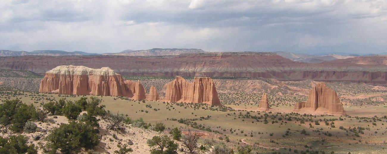
Capitol Reef National Park Hiking Guides & Outfitters
Search Capitol Reef National Park Hiking Guides & Outfitters
tour Results
Plot just the current page's results
Plot all results

5 tour Results
More Info Book Online Official Website Boulder Mountain Guest Ranch Guides & Outfitters
- 3621 Hells Backbone Road, Boulder
- 435-335-7480
More Info Official Website Capitol Reef Adventure Company
- 45 N 100 E, Teasdale
- 435-979-3132
More Info Official Website Capitol Reef Outfitters
- 9 W. Main St., Torrey
- 435-491-2609
More Info Official Website Southwest Adventure Tours
- National Park Tours, Hiking, Sightseeing and Transportation Services
- 435-590-5864
More Info Water Pocket Adventures
- 341 S Pine Drive, Torrey
- 801-400-7558
Capitol Reef National Park Hiking Trails
Search Capitol Reef National Park Hiking Trails
hiking Results
Plot just the current page's results
Plot all results
16 hiking Results
More Info Capitol Gorge Trail
- 5.25 miles oneway
- 3 hours
- Intermediate
More Info Cassiday Arch Trail
- 1.75 mile oneway
- 1-1/2 hours
- Difficult
More Info Cassidy, Rich, & Ledge Point Trails
- 3-9 miles
- 4-6 hours
- Intermediate
More Info Official Website Chimney Rock Trail
- 3.5 mi. semi-loop
- 2-1/2 hours
- Intermediate
More Info Official Website Cohab Canyon Trail
- 1.7 mile roundtrip
- 1-1/2 hours
- Intermediate
More Info Fremont River Trail
- 2 mile roundtrip
- 1-1/2 hours
- Intermediate
More Info Golden Throne Trail
- 4 mile roundtrip
- 2 to 3 hours
- Difficult
More Info Golden Wall, Castle Bridge, & Buckhorn Trails
- 4 miles
- 2-4 hours
- Intermediate
More Info Official Website Grand Wash Trail
- 2.25 miles oneway
- 1-1/2 hours
- Easy
More Info Official Website Hickman Bridge Trail Head
- 2 mile roundtrip
- 1-1/2 hours
- Intermediate
- Loading
Your request has been processed, thank you!
We also have the following visitor guides in Utah. Click on any additional guides you would like to receive.


Bear Lake Northern Utah
Bear Lake

Carbon Corridor Central Utah
Carbon Corridor

Davis County Northern Utah
Davis County

Uintah County - Vernal Northeastern Utah
Uintah County - Vernal

Emery County, Utah South Central Utah
Emery County, Utah

Heber Valley North Central Utah
Heber Valley

Zion National Park - North Rim Grand Canyon Southern Utah
Zion National Park - North Rim Grand Canyon

Moab Southeast Utah
Moab

Park City Summer North Central Utah
Park City Summer

Salt Lake North Central Utah
Salt Lake

San Juan County Southeast Utah
San Juan County

Capitol Reef Country Central Utah
Capitol Reef Country

Cedar City & Brian Head Southern Utah
Cedar City & Brian Head

Logan - Cache Valley Northern Utah
Logan - Cache Valley

Box Elder County Northern Utah
Box Elder County

Bryce Canyon Country Southern Utah
Bryce Canyon Country

Utah - Life Elevated Statewide
Utah - Life Elevated

Flaming Gorge Country Northeastern Utah
Flaming Gorge Country

Palisade, Colorado Western
Palisade, Colorado

Visit Moffat County Northwestern Colorado
Visit Moffat County

Park City Winter North Central Utah
Park City Winter

Ski Utah Utah
Ski Utah

Explore Utah Valley Utah
Explore Utah Valley

Visit Ogden - Northern Utah Ogden
Visit Ogden - Northern Utah
We also have visitor guides available in states highlighted in blue below. Click on any state to see what's available.
- Alaska
- Arizona
- California
- Canada
- Colorado
- Hawaii
- Idaho
- Louisiana
- Michigan
- Montana
- Nevada
- New Mexico
- Ohio
- Oregon
- Texas
- Utah
- Washington
- Wyoming