


Mexican Hat is a tiny desert community of 50 or so people near the southeastern corner of Utah. It sits along the San Juan River among impressive rock formations. In fact, Mexican Hat itself gets its name from a rock formation north of town that resembles an overturned sombrero. The town serves mainly as a stopping off point for those traveling to Monument Valley (22 miles southwest) and Natural Bridges National Monument (44 miles north). Mexican Hat is also a convenient base for those exploring the San Juan River.
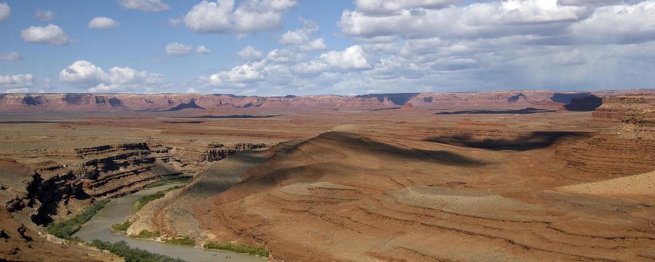
A few other attractions -- Goosenecks State Park, Muley Point Overlook and the Valley of the Gods -- are within 15 miles of town. Goosenecks State Park frames slow, dramatic bends in the San Juan River, bends that have slowly eroded deep canyons in the stone. Muley Point Overlook also deals with the San Juan, allowing the visitor to stare over less dramatic, but plentiful and winding canyons. Valley of the Gods is far dryer, a series of carved buttes and pinnacles reminiscent of the larger Monument Valley.
Mexican Hat is located on Highway 163, 24 miles west of Bluff. It has a few small motels, a private campground, a few restaurants, service stations and some gift shops.
To learn more about Mexican Hat, select a topic of interest from the left-hand column.