Utah Map

Facebook Twitter Google+
Follow The Go Travel Sites on Facebook

San Rafael Swell, Utah - Transportation

Maps, Directions, Airports, Rental Cars, Shuttles,...

Transportation information for San Rafael Swell is provided below. Travel information includes driving directions, maps, airport information and more.

travel planner Results
View
Plot just the current page's results    Plot all   results

Loading Results
 

2 travel planner Results

  • Castle Country - Central Utah

Castle Country - Central Utah Mountain peaks and sandy deserts make up the area of Castle County. In magical Nine Mile Canyon are Native American petroglyphs and other wonderous sights.

  • San Rafael Swell

San Rafael Swell San Rafael Swell, also known as San Rafael Country, is an outdoor adventure loaded with color andSan Rafael Swell Rockart contrast with majestic mountain peaks; great for summer hiking and winter snow shoeing and skiing adventures.

Request Your Free Travel Planners

Airports

There is no nearby air service.

Ground Transportation

  • Transportation Services

Enterprise Rent-A-Car Get a free upgrade on your next rental - most Airport Locations. BOOK NOW! Enterprise Rent-A-Car offers great rates and great service. Choose from over 6,500 locations near your home, work or destination.

  • Heber City
  • Transportation Services
  • 435-654-3962

Utah Scenic Flights Our scenic flights leave from the Heber City Airport in northern Utah. An Aerial Tour of Utah is the most exciting way of experiencing the varied landscapes of this beautiful land. Take a scenic flight with OK3 AIR and discover the natural beauty of Utah, from the Wasatch Mountains to the Henry Mountains in southern Utah!

Basic Directions

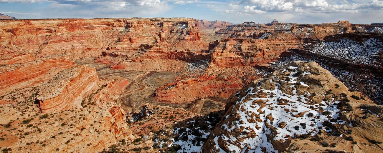
The San Rafael Swell occupies an area 65 miles north to south and 40 miles across. The town of Price is 25 miles north, Green River is 20 miles east.

To help plan your route, please select one of the following maps:

The network of dirt roads within the Swell are often confusing, so if you're going to do a lot of exploring, you'll want a good map. (The San Rafael Desert 1:100,000 USGS Topo Map is good as is the Utah Travel Council's Northeastern Utah section map.)

Customizable Directions

Formatted DirectionsMap
Utah San Rafael Swell SaltLakeCityCVB-Winter2011-12-skyscraper

Email Page Link

Complete the form below to email this page to a friend or family member's email. You can send yourself an email as well. Your email and your recipient's email will NOT be shared with anyone. See our full Privacy Policy for details.
:
:
:


:
Copy Yourself on the Email Yes No
:
: