


Sanpete County is a collection of small towns located in central Utah. Most communities in the area are cradled in the beautiful Sanpete Valley, bound by the Wasatch Plateau on the east and the Sanpitch Mountains on the west. These mountain ranges, and the many lakes and streams in the area, provide a variety of enticing outdoor opportunities.
Ephraim is the largest town in the county and is home to Snow College, which offers two-year degrees and enrolls less than 5,000 students. Nearby Manti is the county seat and is dominated by the large LDS temple on a hill overlooking town, built in 1888. Today it is the site of the highly popular Mormon Miracle Pageant, an annual two-week event attended by an average of 15,000 people per night.
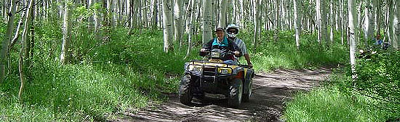
ATVing and dirt biking are popular on Sanpete’s many excellent trails, as well mountain biking, hiking, snowmobiling, and horseback riding. Several lakes in the area are less crowded than other Utah lakes and offer great boating, water skiing, fishing, and camping. The county is only about two hours’ drive south of Salt Lake City and offers most of the same recreational activities as the larger Wasatch Range, but without the crowds.
The towns of Sanpete County include Ephraim, Manti, Fairview, Mt. Pleasant, Spring City, Gunnison, Moroni, Fountain Green, Sterling, Centerfield, and Mayfield. Lodging, supplies, and dining options are more plentiful in Ephraim and Manti but are also found in the other communities. Ephraim and Manti are approximately 125 miles south of Salt Lake City on Highway 89. To learn more about Sanpete County, explore the links to the left.