Utah Map

Request Free Visitor Guides

San Rafael Swell Recreation Area

This record is no longer active on our site.

For more information about Attractions in Green River, Green River (town of) or San Rafael Swell, please search our full coverage of Green River Attractions, Green River (town of) Attractions or San Rafael Swell Attractions.

Contact Info
Bureau of Land Management - Price Field Office
125 South 600 West
Price, UT 84501

Phone:
435-636-3622
Local:
435-636-3622

Description

Elevation 4000 - 7000 feet. A magnificent badlands of brightly colored and wildly eroded sandstone formations, deep canyons, and giant plates of stone tilted upright throgh massive geologic upheaval. There is a picnic area and scenic overlook at Cedar Mountain, or the adventurous can explore the swell however suits you best: on foot, horseback, bike, in an OHV or four wheel drive. Petroglyphs and abandoned uranium mines are scattered throughout the area. Under the emergency order, all public lands, including vehicle ways, are closed to OHVs in the Muddy Creek, Devil's Canyon, Crack Canyon, San Rafael Reef, Horseshoe Canyon and Mexican Mountain WSAs. All public lands in the Sid's Mountain WSA are closed to OHVs with the exception of four identified ways: 1) the wash bottom of Coal Wash, including the short dugway from the west which enters this wash, and North Fork Coal Wash south until it exits the WSA over Fix-It-Pass, 2) the wash bottom of South Fork Coal Wash from its junction with the North Fork to and including the Eva Conover way, 3) the Devil's Racetrack way and 4) the Justensen Flat access way, including lower Eagle Canyon southeast from the junction of this way.

Map + Directions

Basic Directions

I-70 west of Green River, east of UT 10. To get to the overlook, take Cedar Mountain Road from Cleveland.

Customizable Directions


Copyright © 1997 - 2024 The Go Travel Sites. All Rights Reserved and.
Email Page Link

Complete the form below to email this page to a friend or family member's email. You can send yourself an email as well. Your email and your recipient's email will NOT be shared with anyone. See our full Privacy Policy for details.
:
:
:


:
Copy Yourself on the Email Yes No
:
:

1

Select one or more Free Visitor Guides below

2

Complete the form to receive your guides by mail

Below are the Free Visitor Guides for Green River. More Visitor Guides are available in Utah. Click here to view them all!

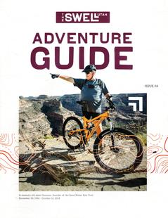
Emery County, Utah Emery County, Utah Emery County, Utah
South Central UtahWelcome to the Swell, a natural playground in the heart of Utah. Within the region, you will find endless opportunities to ride, climb, camp, hike or paddle.
Request this Free Visitor GuideRequested! You're all set! Request a few more Visitor Guides, or complete the form below to receive your guides by mail.
Capitol Reef Country Capitol Reef Country Capitol Reef Country
Central UtahThis area of southern Utah has a diversity of landscape like no other area in the state - red rock formations and canyons, pristine meadows, alpine forests, as well as lush green valleys. That landscape makes Capitol Reef Country perfect for outdoor activities such as hiking, biking, horseback riding, ATV tours, hunting, fishing, wildlife viewing, or just a quiet picnic!
Request this Free Visitor GuideRequested! You're all set! Request a few more Visitor Guides, or complete the form below to receive your guides by mail.
Utah - Life Elevated Utah - Life Elevated Utah - Life Elevated
StatewideWith five national parks and more than 40 state parks, Utah offers a wealth of outdoor activities for families & adventurers alike. Order your free Travel Guide today.
Request this Free Visitor GuideRequested! You're all set! Request a few more Visitor Guides, or complete the form below to receive your guides by mail.
Ski Utah Ski Utah Ski Utah
Utah
Request this Free Visitor GuideRequested! You're all set! Request a few more Visitor Guides, or complete the form below to receive your guides by mail.