


Basics
- Location:
- Stretches between Steamboat Springs and Dinosaur National Monument.
- Length:
- 100 miles oneway
- Difficulty:
- Intermediate,
Advanced - Aerobic Difficulty:
- Difficult
- Time To Allow:
- Varies
- Elevation Range:
- 5079 feet to 7200 feet
- Elevation Change:
- 1121 feet
- Season:
- Spring to Fall
Description
Tour Companies
Holiday River Expeditions - Biking
- Statewide Trips
- Biking
- 800-624-6323
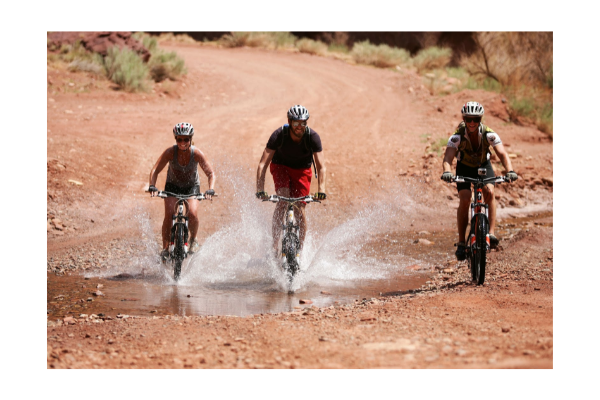 Holiday River Expeditions has provided trips to the most spectacular landscapes on earth since 1966. Utah’s red rock canyons are a mecca for mountain bike trips. Explore some of the west’s most iconic landscapes and world famous trail systems. All trips are fully supported and include expert guides, scrumptious meals, and vehicle support for your gear. Come ride with us!
Helpful Links
Tour Companies
Holiday River Expeditions - Biking
- Statewide Trips
- Biking
- 800-624-6323
Details
Location:
Length:
Difficulty:
Advanced
Aerobic Difficulty:
Time To Allow:
Trailhead Elevation:
Elevation Range:
Elevation Change:
Season:
Map + Directions
Basic Directions
Another access point to over 12 miles of continuous single track can be found along the Deer lodge Park Road. Continue 20 miles west of Maybell to the Deer lodge Road turnoff. Follow the Deer lodge Road 3.5 miles to the Cross Mountain Turnout. Parking is available here and the trail leaves the Deer lodge Road heading west just 200 yards prior to the Cross Mountain Turnout. The Bear Valley Road (County Road 14) at Elk Springs also provides access to the unimproved road portions of the trail system. Travel 12 miles and turn right onto County Road 14N. Travel 2 miles to where this road enters Dinosaur National Monument. Park and ride from this point or others further along the Yampa Bench.
Trail Description
Between Maybell and Cross Mountain the route is primarily two track leading through the rolling sandhills landscape. This area is important winter range for big game wildlife and opportunities to view herds of elk, mule deer and pronghorn are outstanding in the spring. The trail leading over the south end of Cross Mountain begins to take you into the pinyon/juniper woodlands and a spur trial provides access to the Cross Mountain Canyon overlook. The trail segments west of the Deer lodge Road lead to some rugged terrain and steep slopes along the breaks of Twelvemile Mesa. This can be some tough single track riding in remote settings. Big Game wildlife are also abundant in this area. The mesa provides outstanding views of the Lilly Park area and surrounding desert mountains.
The route leading into Dinosaur National Monument offers picturesque canyon terrain of the adjacent Yampa Canyon, desert ecosystem and opportunities to explore remote historic sites abandon by early settlers. This route parallels the rim of the scenic Yampa Canyon and provides numerous opportunities for overlooks. Camping facilities are available in Echo Park at the confluence of the Green and Yampa rivers, and prehistoric Indian rock art can be viewed in this area.


