The prettiest part of the Dog Lake loop is probably the first two miles of the hike, along Butler Fork. Butler Fork meanders northward through a narrow canyon filled with dense groves of quaking aspen, eventually emerging into a more open forest of Engelmann spruce and Douglas fir along the ridge above Mill Creek Canyon. It is not uncommon to see moose along this part of the trail. Look for their hoof tracks along the path-similar to deer tracks, but two to three times larger.
The Lake itself is located in a shallow, heavily forested basin just south of the ridge that separates Mill Creek Canyon from Big Cottonwood Canyon.
Although Dog Lake itself lies outside the Wilderness boundary, Butler Fork is part of the Mount Olympus Wilderness Area and you cannot bring a dog on this part of the hike!
Details
Location:
In Big Cottonwood Canyon southeast of downtown Salt Lake City
Length:
5 mile roundtrip
Difficulty:
Easy
Time:
2-3 hours
Elevation Change:
1680
Season:
June to October
Additional Details:
About 0.5 mile from the Butler Fork Trailhead you will encounter a fork in the trail, with the better used left fork leading to Mill A Basin. Take the right fork for Dog Lake. The trail climbs steadily for another 1.8 miles, finally coming to another fork about 1,680 feet above the trailhead at the top of the ridge. Again, bear right along the crest of the ridge. As you near Dog Lake, about 0.5 mile further east along the ridge, you may be confused by a number of trails that branch off to the north and south. Pay attention to the map, and remember that Dog Lake is just a short way below the ridge on the south side. If you start climbing abruptly to the south you are probably headed for Renolds Peak. If you start descending abruptly to the north you are probably headed down into Mill Creek Canyon. Look for Dog Lake just a few hundred feet after the trail begins descending to the south.
From the southeast corner of Dog Lake a well used mountain bike trail descends for 0.6 mile to another trail junction. Here you will see a sign directing you to either Desolation Lake (left) or Mill D Trailhead (right). Take the right fork to the Mill D Trailhead. You will see a lot more hikers on this side of the loop than you saw along Butler Fork. There are also some summer homes along the east side of Mill D North Fork, and you may catch glimpses of another trail below you that follows the east side of the creek. You will arrive at Big Cottonwood Canyon and the Mill D Trailhead about 2.4 miles after leaving Dog lake.
Map + Directions
Basic Directions
From Downtown Salt Lake City, head south on I-15 about 8 miles to the I-215 Belt Route. Take I-215 East about 5 miles to 6200 South (Exit 6). Bear to the right off the exit ramp onto 6200 South and head east. (It'll turn south after a bit and and merge with Wasatch Boulevard, but just stay on the main road.) Follow it about 2 miles to the light at Big Cottonwood Canyon Road. (On the southwest corner of the intersection is a 7-Eleven gas station and mini-mart.) Take a left and head up canyon. The trailhead is 8 miles past the canyon entrance on the north side of the road. (Note: Along the trip from downtown you'll see large signs to the Solitude and Brighton ski resorts. These resorts are at the top of Big Cottonwood Canyon, so if you follow those signs, you'll get to Big Cottonwood Canyon just fine.)
Below are the Free Visitor Guides for Price. More Visitor Guides are available in Utah. Click here to view them all!
Utah - Life Elevated Statewide
Utah - Life Elevated
StatewideWith five national parks and more than 40 state parks, Utah offers a wealth of outdoor activities for families & adventurers alike. Order your free Travel Guide today. Request this Free Visitor GuideRequested!You're all set! Request a few more Visitor Guides, or complete the form below to receive your guides by mail.
Emery County, Utah South Central Utah
Emery County, Utah
South Central UtahWelcome to the Swell, a natural playground in the heart of Utah. Within the region, you will find endless opportunities to ride, climb, camp, hike or paddle. Request this Free Visitor GuideRequested!You're all set! Request a few more Visitor Guides, or complete the form below to receive your guides by mail.
We also have the following visitor guides in Utah. Click on any additional guides you would like to receive.
Utah - Life Elevated Statewide
Utah - Life Elevated
StatewideWith five national parks and more than 40 state parks, Utah offers a wealth of outdoor activities for families & adventurers alike. Order your free Travel Guide today. Request this Free Visitor GuideRequested!You're all set! Request a few more Visitor Guides, or complete the form below to receive your guides by mail.
Emery County, Utah South Central Utah
Emery County, Utah
South Central UtahWelcome to the Swell, a natural playground in the heart of Utah. Within the region, you will find endless opportunities to ride, climb, camp, hike or paddle. Request this Free Visitor GuideRequested!You're all set! Request a few more Visitor Guides, or complete the form below to receive your guides by mail.
Flaming Gorge Country Northeastern Utah
Flaming Gorge Country
Northeastern UtahThe entire area comprising Flaming Gorge Country is one that can be compared to nothing short of breathtaking. Whether you’re taking in the beautiful scenery, enjoying the numerous activities available or simply relaxing and enjoying the slower-paced lifestyle we enjoy here, there's an abundance of resources that are sure to bring a smile to your face. Request this Free Visitor GuideRequested!You're all set! Request a few more Visitor Guides, or complete the form below to receive your guides by mail.
Bear Lake Northern Utah
Bear Lake
Northern UtahBear Lake Valley lies on the border of Utah and Idaho, and is home to the "Caribbean of the Rockies", or Bear Lake. Visitors can enjoy a myriad of outdoor activities throughout the entire year. Request this Free Visitor GuideRequested!You're all set! Request a few more Visitor Guides, or complete the form below to receive your guides by mail.
Davis County Northern Utah
Davis County
Northern UtahJust north of Salt Lake City, Davis County is known as the ultimate playground for fun, entertainment, and outdoor adventure. Within minutes, you can enjoy a round of golf at one of ten courses, explore over 500 miles of trails and bikeways, ski world-class downhill slopes, go sightseeing at Antelope Island State Park and the Great Salt Lake, or enjoy family fun at seven different amusement centers like Lagoon, the largest amusement park in the Intermountain West. Request this Free Visitor GuideRequested!You're all set! Request a few more Visitor Guides, or complete the form below to receive your guides by mail.
Uintah County - Vernal Northeastern Utah
Uintah County - Vernal
Northeastern UtahEnjoy Dinosaur National Monument, scenic byways, state parks, wilderness areas, heritage trails, petroglyphs, and family fun. It's world-class fishing, river running, biking, hiking, and camping in alpine meadows and red rock canyons. Request this Free Visitor GuideRequested!You're all set! Request a few more Visitor Guides, or complete the form below to receive your guides by mail.
Heber Valley North Central Utah
Heber Valley
North Central UtahHeber Valley is a true “Four Season” destination beautifully situated between the towering Wasatch and Uinta mountain ranges amidst gorgeous lakes, blue-ribbon trout streams and top rated golf courses. Request this Free Visitor GuideRequested!You're all set! Request a few more Visitor Guides, or complete the form below to receive your guides by mail.
Zion National Park - North Rim Grand Canyon Southern Utah
Zion National Park - North Rim Grand Canyon
Southern UtahTravel information on the North Rim Grand Canyon, Zion National Park, Lake Powell, Kanab and Bryce Canyon Nation Park - Visit the Heart of the Parks. Request this Free Visitor GuideRequested!You're all set! Request a few more Visitor Guides, or complete the form below to receive your guides by mail.
Moab Southeast Utah
Moab
Southeast UtahMoab has long been a favorite destination for locals and world travelers alike. Southeast Utah is a must for any Utah traveler's itinerary. Request this Free Visitor GuideRequested!You're all set! Request a few more Visitor Guides, or complete the form below to receive your guides by mail.
Park City Summer North Central Utah
Park City Summer
North Central UtahMade famous by the Sundance Film Festival, Park City is a favorite with locals and the world. Ski resorts, scenic beauty, and Main Street draw visitors to this mountain city. Request this Free Visitor GuideRequested!You're all set! Request a few more Visitor Guides, or complete the form below to receive your guides by mail.
San Juan County Southeast Utah
San Juan County
Southeast UtahSan Juan County is located in the Four Corners region of the southwest United States. Visitors come to experience the unique culture and natural history of the area. Request this Free Visitor GuideRequested!You're all set! Request a few more Visitor Guides, or complete the form below to receive your guides by mail.
Central UtahThis area of southern Utah has a diversity of landscape like no other area in the state - red rock formations and canyons, pristine meadows, alpine forests, as well as lush green valleys. That landscape makes Capitol Reef Country perfect for outdoor activities such as hiking, biking, horseback riding, ATV tours, hunting, fishing, wildlife viewing, or just a quiet picnic! Request this Free Visitor GuideRequested!You're all set! Request a few more Visitor Guides, or complete the form below to receive your guides by mail.
Visit Moffat County Northwestern Colorado
Visit Moffat County
Northwestern ColoradoWelcome to Colorado’s Great Northwest, Moffat County has nearly 2 million acres of public lands to explore. Experience places like Dinosaur National Monument, the Sand Wash Basin Wild Horse Management Area and free flowing rivers including the mighty Yampa, last of the wild ones! Request this Free Visitor GuideRequested!You're all set! Request a few more Visitor Guides, or complete the form below to receive your guides by mail.
Park City Winter North Central Utah
Park City Winter
North Central UtahMade famous by the Sundance Film Festival, Park City is a favorite with locals and the world. Ski resorts, scenic beauty, and Main Street draw visitors to this mountain city. Request this Free Visitor GuideRequested!You're all set! Request a few more Visitor Guides, or complete the form below to receive your guides by mail.
UtahUtah Valley is one of the best family vacation destinations offering year-round adventure. Utah vacations start with enjoying the natural beauty and diversity of the Wasatch Front. Hang gliding, world-class fly-fishing, skiing, and dinosaur hunting are just a few of the many outdoor adventures in Utah Valley. Utah vacations also incorporate a modern element of resorts and lodging, museums, performing arts, festivals and much more. Request this Free Visitor GuideRequested!You're all set! Request a few more Visitor Guides, or complete the form below to receive your guides by mail.
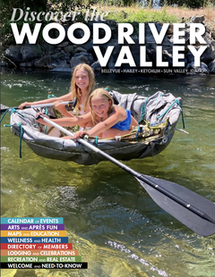
Discover Wood River Valley - Sun Valley Mountains
Discover Wood River Valley - Sun Valley
Mountains All the Best Adventures
For those with a High Altitude Attitude. Discover our Award Winning Visitor’s Guide Request this Free Visitor GuideRequested!You're all set! Request a few more Visitor Guides, or complete the form below to receive your guides by mail.
Southern UtahCedar City hosts the Utah Shakespearean Festival every year. The area surrounding Cedar City is a natural wonderland cherished by nature-lovers. Request this Free Visitor GuideRequested!You're all set! Request a few more Visitor Guides, or complete the form below to receive your guides by mail.
Logan - Cache Valley Northern Utah
Logan - Cache Valley
Northern UtahCache Valley is known as one of Utah's most naturally beautiful areas. For a real treat, take a breathtaking drive along the Logan Canyon national Scenic Byway. Request this Free Visitor GuideRequested!You're all set! Request a few more Visitor Guides, or complete the form below to receive your guides by mail.
Box Elder County Northern Utah
Box Elder County
Northern UtahBox Elder County is known as a land of contrasts. Visit the the quaint and beautiful town of Brigham City, or get outside and experience any number of outdoor activities within scenic Box Elder County. Request this Free Visitor GuideRequested!You're all set! Request a few more Visitor Guides, or complete the form below to receive your guides by mail.
Southern UtahBryce Canyon Country is home to several scenically diverse state/national parks. Visitors will want to spend at least a few days exploring this spectacular part of Utah. Request this Free Visitor GuideRequested!You're all set! Request a few more Visitor Guides, or complete the form below to receive your guides by mail.
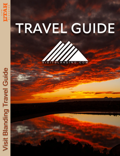
Visit Blanding Southeastern Utah
Visit Blanding
Southeastern UtahBlanding is your gateway to so many amazing experiences. Centrally located within 90 miles of 17 National Monuments & State Parks including Bears Ears, Natural Bridges, and Hovenweep National Monuments. But you can't see it all in just one day, you must consider staying a few days to take it all in and explore Utah's Backcountry! Request this Free Visitor GuideRequested!You're all set! Request a few more Visitor Guides, or complete the form below to receive your guides by mail.
We also have visitor guides available in states highlighted in blue below. Click on any state to see what's available.
Alaska
Arizona
California
Canada
Colorado
Hawaii
Idaho
Michigan
Montana
Nevada
New Mexico
Ohio
Oregon
Texas
Utah
Washington
Wyoming
Switch to Mobile Browser Mode
We offer a compact version of Go-Utah for mobile users, allowing you to access just the information you need on the road. Of course, you can still use the full version of Go-Utah on your mobile device just as you can on your desktop.


")