


Basics
- Difficulty:
- Intermediate
- Elevation Change:
- 1218 feet
Description
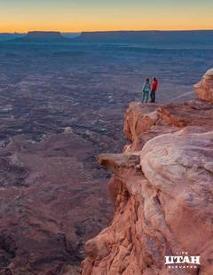
The Maple Canyon Loop Trail offers an arch, trees and a great view of Sanpete County.
Take State Road 116 from Moroni and travel 2.7 miles until you reach West Side Road. Drive north 1.3 miles and turn west on Freedom Road. Watch for signs to Maple Canyon, which should be about 2.5 miles away. As you enter the canyon, look for the Forest Service campground. You should notice the trailhead at the entrance to the campground.
The trailhead begins on the Middle Fork. Once you’ve walked about half a mile look for a sign that will lead you off the main trail to an arch. Once you return the main trail, look for a sign to the Right Fork. There should be a bench that provides an overlook. The trail then continues downhill back to the campground.
Details
Difficulty:
Intermediate
Elevation Change:
1218