


Presented below are Tour Companies that offer guided hiking trips and/or the gear you need in Utah. Click on any name for more detailed information.
Utah Hiking Guides & Outfitters
Search Utah Hiking Guides & Outfitters
tour Results
Plot just the current page's results
Plot all results
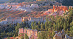
Utah Hiking Trails
Search Utah Hiking Trails
hiking Results
Plot just the current page's results
Plot all results

296 hiking Results
- Page 1
- Page 2
- Page 3
- Page 4
- Page 5
- Page 6
- Page 7
- Page 8
- Page 9
- Page 10
- Page 11
- Page 12
- Page 13
- Page 14
- Page 15
- Page 16
- Page 17
- Page 18
- Page 19
- Page 20
- Page 21
- Page 22
- Page 23
- Page 24
- Page 25
- Page 26
- Page 27
- Page 28
- Page 29
- Page 30
More Info Lake Hardy by Hammongog Route
- 10 mile roundtrip
- 5-1/2 to 6-1/2 hours
- Difficult
More Info Lake Hardy from Dry Creek Canyon
- 11.5 mile roundtrip
- 5-1/2 to 6-1/2 hours
- Difficult
More Info Lake Mary- Grizzly Gulch
- Salt Lake City - Little Cottonwood Canyon
- 6.4 miles (plus 2.5 miles by bicycle)
- 4 1/4 hours
- Intermediate
More Info Lake Solitude from Silver Lake Trail Head
- Salt Lake City - Big Cottonwood Canyon
- 2.8 miles roundtrip
- 1.5 hours
- Easy
More Info Lambs Canyon Pass from Elbow Fork
- Salt Lake City - Mill Creek Canyon
- 3.4 mile roundtrip
- 2 hours
- Easy
More Info Official Website Landscape Arch Trail
- 1.6 mile roundtrip
- 1 hour
- Easy
More Info Ledges Trail
- 1 mile
- 1 hour
- Easy
More Info Left Hand Fork-East Fork Bear Trail -- Alsop Lake
- 5 miles oneway
- 1 to 1 1/2 hours
- Intermediate
More Info Official Website Limber Pine Nature Trail
- 1 mile partial loop
- 45 mins.
- Easy
More Info Little Black Mountain from Perry's Hollow
- Salt Lake City Foothills
- 9.6 mile roundtrip
- 4 to 4-1/2 hours
- Intermediate
- Loading
Your request has been processed, thank you!
We also have visitor guides available in states highlighted in blue below. Click on any state to see what's available.
- Alaska
- Arizona
- California
- Canada
- Colorado
- Hawaii
- Idaho
- Louisiana
- Michigan
- Montana
- Nevada
- New Mexico
- Ohio
- Oregon
- Texas
- Utah
- Washington
- Wyoming

