Utah Map

Request Free Visitor Guides

Bonneville Shoreline Trail - Provo Canyon

Basics
Length:
6 mile roundtrip
Difficulty:
Intermediate
Time To Allow:
1 to 3 hours
Elevation Change:
500 feet
Season:
Mid-April to Mid-October

Description

The Bonneville Shoreline Trail is a series of trails along the slope of the Wasatch Mountains where the old shoreline of Lake Bonneville met the hills. Sections of trail are found from Ogden to Payson. The Provo Canyon section of the Bonneville Shoreline Trail is an advanced-intermediate singletrack hill climb, followed by a fairly flat cruise out to a view over Utah Valley. Altitude gain is 500 feet, but feels like more. Out-and-back to the viewpoint is 6 miles.

Details

Length:
6 mile roundtrip
Difficulty:
Intermediate
Time To Allow:
1 to 3 hours
Elevation Change:
500
Season:
Mid-April to Mid-October
Additional Details:
Despite the low beginning altitude of 4850 feet, this is not an all-season trail. Because it hugs a steep northern slope, snow closes the trail by late October and remains until late April. During the summer, mid-day riding is blistering hot, so plan an early morning ride.

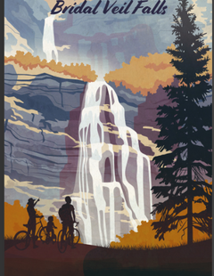
The trail starts on the Provo River Parkway, between the Bridal Veil Park parking lot and Bridal Veil Falls. About 0.1 mile up the paved path, look for the Bonneville Shoreline sign and a singletrack on your right. It''s a fairly steady climb, gaining about 500 feet over the first mile.

After the initial climb, the trail intersects the southern pipeline. Here, the trail flattens and winds around the hillside, generally staying over or near the pipeline. Some short sections will be doubletrack. The trail is intersected by multiple ATV and doubletracks. When in doubt, look around for the most flat trail -- if you''re making a stiff climb or descent at this point, you''re off the pipeline trail.

The sideslope is quite steep, and there are occasional rough sections that might make beginners nervous. During the climb, you''ll be riding through gamble oak, maple, currant, oregon grape, and an occasional pine.

As you come around the mountain onto the old Lake Bonneville gravel deposits, the scenery turns to dry grass, brush, and short scrub oak. Now you can look down towards Utah Valley, and up Provo Canyon.

At around 2.5 miles, the new singletrack climbs up over the ridge to your left. Note the spot, but continue on the pipeline trail out to the viewpoint 1/2 mile later. Say "Oooh, Awww." Then if you want more riding, come back to the singletrack and climb. After crossing the ridge, the singletrack dumps onto an ATV trail with multiple branches. If you continue to select the most flat trail, you''ll arrive on top of a buried water tank overlooking northern Provo''s homes, stables, and corrals.

Information provided by utahmountainbiking.com.

Map + Directions

Basic Directions
The trail is accessed from the Provo Canyon Parkway, a paved recreation trail. The closest trailhead is at the Bridal Veil Park parking lot. Pull off US-189 two miles up Provo Canyon at the Bridal Veil Park - Nunns Park exit, then turn right into the parking lot. The trail on the right side, just where the road turns into the parking lot at GPS N 40° 20.249' W 111° 36.578'. Many riders park at the mouth of Provo Canyon on Orem's 800 North Street (parking is left just past the gas station as you reach the canyon, before you enter the overpass). GPS N 40° 18.840' W 111° 39.472'.

Copyright © 1997 - 2024 The Go Travel Sites. All Rights Reserved and.

Email Page Link

Complete the form below to email this page to a friend or family member's email. You can send yourself an email as well. Your email and your recipient's email will NOT be shared with anyone. See our full Privacy Policy for details.
:
:
:


:
Copy Yourself on the Email Yes No
:
:

1

Select one or more Free Visitor Guides below

2

Complete the form to receive your guides by mail

Below are the Free Visitor Guides for Provo. More Visitor Guides are available in Utah. Click here to view them all!

Heber Valley Heber Valley Heber Valley
North Central UtahHeber Valley is a true “Four Season” destination beautifully situated between the towering Wasatch and Uinta mountain ranges amidst gorgeous lakes, blue-ribbon trout streams and top rated golf courses.
Request this Free Visitor GuideRequested! You're all set! Request a few more Visitor Guides, or complete the form below to receive your guides by mail.
Utah - Life Elevated Utah - Life Elevated Utah - Life Elevated
StatewideWith five national parks and more than 40 state parks, Utah offers a wealth of outdoor activities for families & adventurers alike. Order your free Travel Guide today.
Request this Free Visitor GuideRequested! You're all set! Request a few more Visitor Guides, or complete the form below to receive your guides by mail.
Ski Utah Ski Utah Ski Utah
Utah
Request this Free Visitor GuideRequested! You're all set! Request a few more Visitor Guides, or complete the form below to receive your guides by mail.
Explore Utah Valley Explore Utah Valley Explore Utah Valley
UtahUtah Valley is one of the best family vacation destinations offering year-round adventure. Utah vacations start with enjoying the natural beauty and diversity of the Wasatch Front. Hang gliding, world-class fly-fishing, skiing, and dinosaur hunting are just a few of the many outdoor adventures in Utah Valley. Utah vacations also incorporate a modern element of resorts and lodging, museums, performing arts, festivals and much more.
Request this Free Visitor GuideRequested! You're all set! Request a few more Visitor Guides, or complete the form below to receive your guides by mail.