Presented below are Tour Companies that offer guided hiking trips and adventures in and near Moab. Click on any name for more detailed information.
Moab Hiking Guides & Outfitters
Search Moab Hiking Guides & Outfitters
tour Results
Plot just the current page's results
Plot all results

5 tour Results
More Info Official Website Desert Highlights
- 16 S 100 E, Moab
- 435-259-4433
More Info Official Website Moab Adventure Center - Hiking
- 225 South Main Street, Moab
- 435-259-7019
More Info Official Website Moab Desert Adventures
- Moab, Utah
- 804-814-3872
More Info Official Website Red River Adventures
- 1140 South Main Street, Moab
- 435-259-4046
More Info Official Website Southwest Adventure Tours
- National Park Tours, Hiking, Sightseeing and Transportation Services
- 435-590-5864
Moab Hiking Trails
Search Moab Hiking Trails
hiking Results
Plot just the current page's results
Plot all results
46 hiking Results
More Info Spanish Bottom Trail
- 4.5 mile roundtrip
- 2 to 3 hours
- Intermediate
More Info Official Website Balanced Rock Trail
- .3 mile loop
- 1/2 hour
- Easy
More Info Behind The Rocks Trail
- Varies
- 1 to 4 hours
- Intermediate
More Info Big Spring to Squaw Canyon Trail
- 3.75 miles oneway
- 2-1/2 hours
- Intermediate
More Info Cave Springs Trailhead
- .6 mile loop
- 1/2 hour
- Easy
More Info Chesler Park Loop Trail
- 4.5 mile loop
- 3 hours
- Intermediate
More Info Confluence Overlook Trail
- 10 mile roundtrip
- 5 to 6 hours
- Intermediate
More Info Corona Arch
- 3 mile roundtrip
- 1-1/2 to 2 hours
- Intermediate
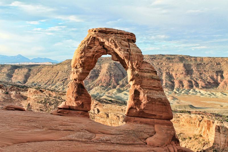
More Info Official Website Delicate Arch Trail
- 3 mile roundtrip
- 2 hours
- Intermediate
More Info Official Website Devil's Garden Trailhead
- 7.6 miles (loop)
- 4 1/4 hours
- Easy
- Loading
Your request has been processed, thank you!
We also have the following visitor guides in Utah. Click on any additional guides you would like to receive.


Bear Lake Northern Utah
Bear Lake

Carbon Corridor Central Utah
Carbon Corridor

Davis County Northern Utah
Davis County

Uintah County - Vernal Northeastern Utah
Uintah County - Vernal

Emery County, Utah South Central Utah
Emery County, Utah

Heber Valley North Central Utah
Heber Valley

Zion National Park - North Rim Grand Canyon Southern Utah
Zion National Park - North Rim Grand Canyon

Moab Southeast Utah
Moab

Park City Summer North Central Utah
Park City Summer

Salt Lake North Central Utah
Salt Lake

San Juan County Southeast Utah
San Juan County

Capitol Reef Country Central Utah
Capitol Reef Country

Cedar City & Brian Head Southern Utah
Cedar City & Brian Head

Logan - Cache Valley Northern Utah
Logan - Cache Valley

Box Elder County Northern Utah
Box Elder County

Bryce Canyon Country Southern Utah
Bryce Canyon Country

Utah - Life Elevated Statewide
Utah - Life Elevated

Flaming Gorge Country Northeastern Utah
Flaming Gorge Country

Palisade, Colorado Western
Palisade, Colorado

Visit Moffat County Northwestern Colorado
Visit Moffat County

Park City Winter North Central Utah
Park City Winter

Ski Utah Utah
Ski Utah

Explore Utah Valley Utah
Explore Utah Valley

Visit Ogden - Northern Utah Ogden
Visit Ogden - Northern Utah
We also have visitor guides available in states highlighted in blue below. Click on any state to see what's available.
- Alaska
- Arizona
- California
- Canada
- Colorado
- Hawaii
- Idaho
- Louisiana
- Michigan
- Montana
- Nevada
- New Mexico
- Ohio
- Oregon
- Texas
- Utah
- Washington
- Wyoming