Below are the Free Visitor Guides for Uinta Mountains. More Visitor Guides are available in Utah. Click here to view them all!
Uintah County - Vernal Northeastern Utah
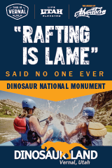
Uintah County - Vernal
Northeastern UtahEnjoy Dinosaur National Monument, scenic byways, state parks, wilderness areas, heritage trails, petroglyphs, and family fun. It's world-class fishing, river running, biking, hiking, and camping in alpine meadows and red rock canyons. Request this Free Visitor GuideRequested!You're all set! Request a few more Visitor Guides, or complete the form below to receive your guides by mail.
Heber Valley North Central Utah
Heber Valley
North Central UtahHeber Valley is a true “Four Season” destination beautifully situated between the towering Wasatch and Uinta mountain ranges amidst gorgeous lakes, blue-ribbon trout streams and top rated golf courses. Request this Free Visitor GuideRequested!You're all set! Request a few more Visitor Guides, or complete the form below to receive your guides by mail.
Utah - Life Elevated Statewide
Utah - Life Elevated
StatewideWith five national parks and more than 40 state parks, Utah offers a wealth of outdoor activities for families & adventurers alike. Order your free Travel Guide today. Request this Free Visitor GuideRequested!You're all set! Request a few more Visitor Guides, or complete the form below to receive your guides by mail.
We also have the following visitor guides in Utah. Click on any additional guides you would like to receive.
Bear Lake Northern Utah
Bear Lake
Northern UtahBear Lake Valley lies on the border of Utah and Idaho, and is home to the "Caribbean of the Rockies", or Bear Lake. Visitors can enjoy a myriad of outdoor activities throughout the entire year. Request this Free Visitor GuideRequested!You're all set! Request a few more Visitor Guides, or complete the form below to receive your guides by mail.
Carbon Corridor Central Utah
Carbon Corridor
Central UtahCradled by the Book Cliffs, this land boasts rich history reflected in ancient rock art, scenic and adventurous outdoor opportunities, and museums that educate about the region’s history. Request this Free Visitor GuideRequested!You're all set! Request a few more Visitor Guides, or complete the form below to receive your guides by mail.
Davis County Northern Utah
Davis County
Northern UtahJust north of Salt Lake City, Davis County is known as the ultimate playground for fun, entertainment, and outdoor adventure. Within minutes, you can enjoy a round of golf at one of ten courses, explore over 500 miles of trails and bikeways, ski world-class downhill slopes, go sightseeing at Antelope Island State Park and the Great Salt Lake, or enjoy family fun at seven different amusement centers like Lagoon, the largest amusement park in the Intermountain West. Request this Free Visitor GuideRequested!You're all set! Request a few more Visitor Guides, or complete the form below to receive your guides by mail.
Uintah County - Vernal Northeastern Utah
Uintah County - Vernal
Northeastern UtahEnjoy Dinosaur National Monument, scenic byways, state parks, wilderness areas, heritage trails, petroglyphs, and family fun. It's world-class fishing, river running, biking, hiking, and camping in alpine meadows and red rock canyons. Request this Free Visitor GuideRequested!You're all set! Request a few more Visitor Guides, or complete the form below to receive your guides by mail.
Emery County, Utah South Central Utah
Emery County, Utah
South Central UtahWelcome to the Swell, a natural playground in the heart of Utah. Within the region, you will find endless opportunities to ride, climb, camp, hike or paddle. Request this Free Visitor GuideRequested!You're all set! Request a few more Visitor Guides, or complete the form below to receive your guides by mail.
Heber Valley North Central Utah
Heber Valley
North Central UtahHeber Valley is a true “Four Season” destination beautifully situated between the towering Wasatch and Uinta mountain ranges amidst gorgeous lakes, blue-ribbon trout streams and top rated golf courses. Request this Free Visitor GuideRequested!You're all set! Request a few more Visitor Guides, or complete the form below to receive your guides by mail.
Zion National Park - North Rim Grand Canyon Southern Utah
Zion National Park - North Rim Grand Canyon
Southern UtahTravel information on the North Rim Grand Canyon, Zion National Park, Lake Powell, Kanab and Bryce Canyon Nation Park - Visit the Heart of the Parks. Request this Free Visitor GuideRequested!You're all set! Request a few more Visitor Guides, or complete the form below to receive your guides by mail.
Moab Southeast Utah
Moab
Southeast UtahMoab has long been a favorite destination for locals and world travelers alike. Southeast Utah is a must for any Utah traveler's itinerary. Request this Free Visitor GuideRequested!You're all set! Request a few more Visitor Guides, or complete the form below to receive your guides by mail.
Park City Summer North Central Utah
Park City Summer
North Central UtahMade famous by the Sundance Film Festival, Park City is a favorite with locals and the world. Ski resorts, scenic beauty, and Main Street draw visitors to this mountain city. Request this Free Visitor GuideRequested!You're all set! Request a few more Visitor Guides, or complete the form below to receive your guides by mail.
Salt Lake North Central Utah
Salt Lake
North Central UtahSalt Lake City is the cultural center of Utah and where most of the state's people reside. There is plenty to see and do here, just ask the locals. Request this Free Visitor GuideRequested!You're all set! Request a few more Visitor Guides, or complete the form below to receive your guides by mail.
San Juan County Southeast Utah
San Juan County
Southeast UtahSan Juan County is located in the Four Corners region of the southwest United States. Visitors come to experience the unique culture and natural history of the area. Request this Free Visitor GuideRequested!You're all set! Request a few more Visitor Guides, or complete the form below to receive your guides by mail.
Capitol Reef Country Central Utah
Capitol Reef Country
Central UtahThis area of southern Utah has a diversity of landscape like no other area in the state - red rock formations and canyons, pristine meadows, alpine forests, as well as lush green valleys. That landscape makes Capitol Reef Country perfect for outdoor activities such as hiking, biking, horseback riding, ATV tours, hunting, fishing, wildlife viewing, or just a quiet picnic! Request this Free Visitor GuideRequested!You're all set! Request a few more Visitor Guides, or complete the form below to receive your guides by mail.
Cedar City & Brian Head Southern Utah
Cedar City & Brian Head
Southern UtahCedar City hosts the Utah Shakespearean Festival every year. The area surrounding Cedar City is a natural wonderland cherished by nature-lovers. Request this Free Visitor GuideRequested!You're all set! Request a few more Visitor Guides, or complete the form below to receive your guides by mail.
Logan - Cache Valley Northern Utah
Logan - Cache Valley
Northern UtahCache Valley is known as one of Utah's most naturally beautiful areas. For a real treat, take a breathtaking drive along the Logan Canyon national Scenic Byway. Request this Free Visitor GuideRequested!You're all set! Request a few more Visitor Guides, or complete the form below to receive your guides by mail.
Box Elder County Northern Utah
Box Elder County
Northern UtahBox Elder County is known as a land of contrasts. Visit the the quaint and beautiful town of Brigham City, or get outside and experience any number of outdoor activities within scenic Box Elder County. Request this Free Visitor GuideRequested!You're all set! Request a few more Visitor Guides, or complete the form below to receive your guides by mail.
Bryce Canyon Country Southern Utah
Bryce Canyon Country
Southern UtahBryce Canyon Country is home to several scenically diverse state/national parks. Visitors will want to spend at least a few days exploring this spectacular part of Utah. Request this Free Visitor GuideRequested!You're all set! Request a few more Visitor Guides, or complete the form below to receive your guides by mail.
Utah - Life Elevated Statewide
Utah - Life Elevated
StatewideWith five national parks and more than 40 state parks, Utah offers a wealth of outdoor activities for families & adventurers alike. Order your free Travel Guide today. Request this Free Visitor GuideRequested!You're all set! Request a few more Visitor Guides, or complete the form below to receive your guides by mail.
Flaming Gorge Country Northeastern Utah
Flaming Gorge Country
Northeastern UtahThe entire area comprising Flaming Gorge Country is one that can be compared to nothing short of breathtaking. Whether you’re taking in the beautiful scenery, enjoying the numerous activities available or simply relaxing and enjoying the slower-paced lifestyle we enjoy here, there's an abundance of resources that are sure to bring a smile to your face. Request this Free Visitor GuideRequested!You're all set! Request a few more Visitor Guides, or complete the form below to receive your guides by mail.
Northwestern ColoradoWelcome to Colorado’s Great Northwest, Moffat County has nearly 2 million acres of public lands to explore. Experience places like Dinosaur National Monument, the Sand Wash Basin Wild Horse Management Area and free flowing rivers including the mighty Yampa, last of the wild ones! Request this Free Visitor GuideRequested!You're all set! Request a few more Visitor Guides, or complete the form below to receive your guides by mail.
Park City Winter North Central Utah
Park City Winter
North Central UtahMade famous by the Sundance Film Festival, Park City is a favorite with locals and the world. Ski resorts, scenic beauty, and Main Street draw visitors to this mountain city. Request this Free Visitor GuideRequested!You're all set! Request a few more Visitor Guides, or complete the form below to receive your guides by mail.
UtahUtah Valley is one of the best family vacation destinations offering year-round adventure. Utah vacations start with enjoying the natural beauty and diversity of the Wasatch Front. Hang gliding, world-class fly-fishing, skiing, and dinosaur hunting are just a few of the many outdoor adventures in Utah Valley. Utah vacations also incorporate a modern element of resorts and lodging, museums, performing arts, festivals and much more. Request this Free Visitor GuideRequested!You're all set! Request a few more Visitor Guides, or complete the form below to receive your guides by mail.
We also have visitor guides available in states highlighted in blue below. Click on any state to see what's available.
Alaska
Arizona
California
Canada
Colorado
Hawaii
Idaho
Louisiana
Michigan
Montana
Nevada
New Mexico
Ohio
Oregon
Texas
Utah
Washington
Wyoming
Switch to Mobile Browser Mode
We offer a compact version of Go-Utah for mobile users, allowing you to access just the information you need on the road. Of course, you can still use the full version of Go-Utah on your mobile device just as you can on your desktop.